At the beginning of October I made a research trip to Gibraltar. I stayed in a house share with some residents, who were delighted to introduce me to all manner of local characters and spill the tea on all sorts of Gib intrigue. The rock itself is three miles long and one mile wide, and the inside is riddled with 34 miles of tunnels, mostly dug by the Ministry of Defence during WWII.
This is a selection of the photos I took as an aide-memoire for my writing process. Enjoy!
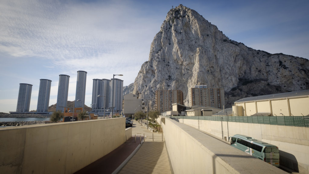
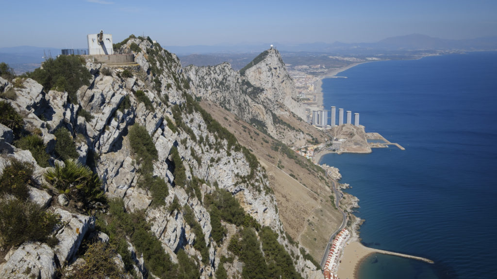
The eastern side of the rock is traditionally more sparsely populated, although a recent land reclamation programme, and the construction of this tower block complex is beginning to change that.
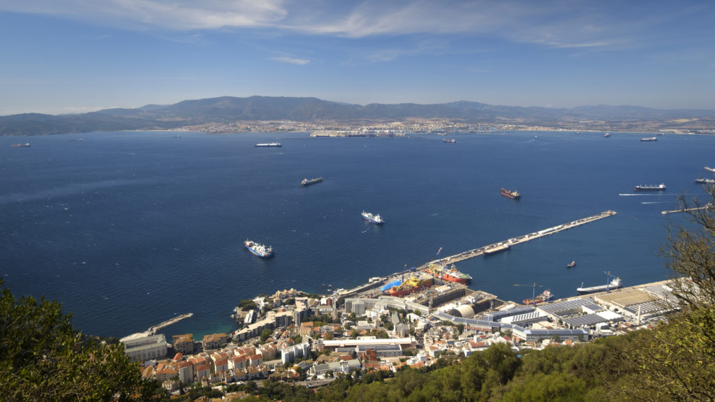
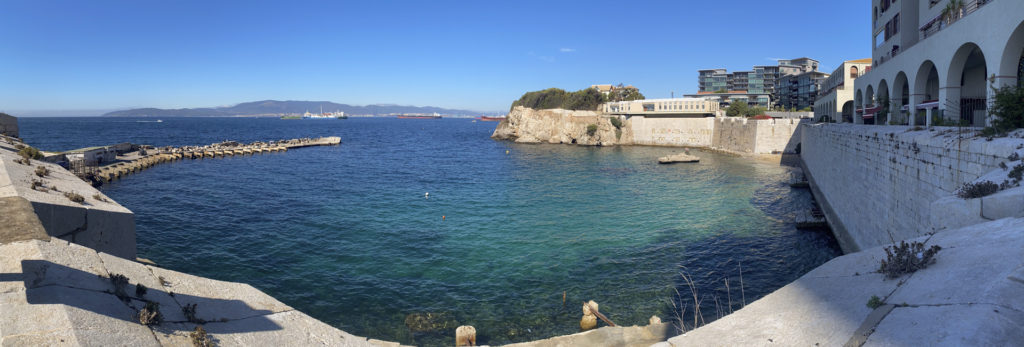
The western side of the rock has a sizeable harbour, again mostly built on reclaimed land. The way the landmass of Gibraltar keeps growing is something of a bone of contention with neighbouring Spain, but the major issue really is the treaty of Utrecht (1713) in which the Spanish crown ceded the territory to Britain ‘in perpetuity’. They’ve regretted it ever since. Gibraltarians insist that the rock is not Spain’s to claim, nor Britain’s to give away.
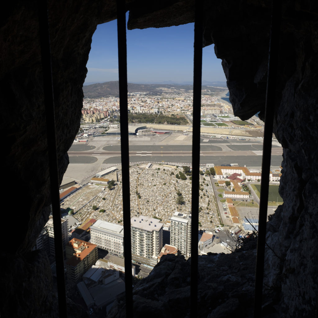
The military history of the rock is fascinating, and has had a lasting effect on the sense of place. This is a view from an old canon embrasure towards the border with Spain. The area of no-man’s-land first saw the development of a strategically placed cemetery, and further out a racecourse which saw improvised use as an early airfield before being developed into the airport. Every journey from the city centre to La Linéa on the other side of the border means crossing the runway either by walking across it or driving under it.
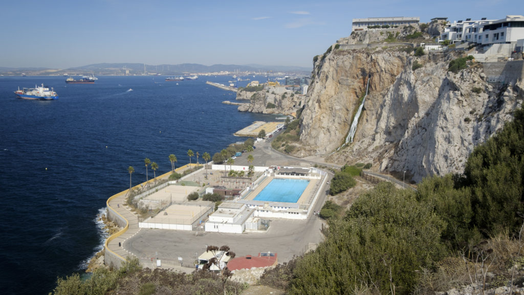
This area, Camp Bay, was reclaimed through the forced labour of Italian prisoners of war in WWII. The only way out of this area was through a tightly-guarded tunnel to the north, so it was both an effective prison and a smart land reclamation scheme. A sizeable number of the prisoners of war chose to stay on in Gibraltar after the war, married local women, and added to the incredible diversity of this tiny place.
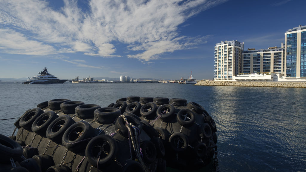
Further north, an area of reclaimed land forms a harbour and a bunkering (refuelling) port conveniently placed at the mouth of the Mediterraean Sea. Billionaire’s yachts are regularly at anchor just offshore.
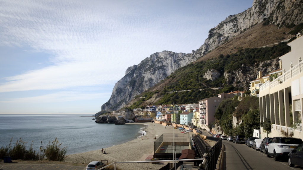
Catalan Bay, on the east of the rock, is a popular weekend getaway spot for folks who live in the more crowded west, less than a mile away. Car use is surprisingly really widespread. I travelled around the island on an electric mountain bike, and if I lived on the rock an electric cargo bike would serve all my needs perfectly adequately.
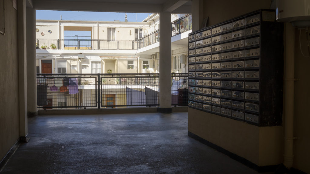
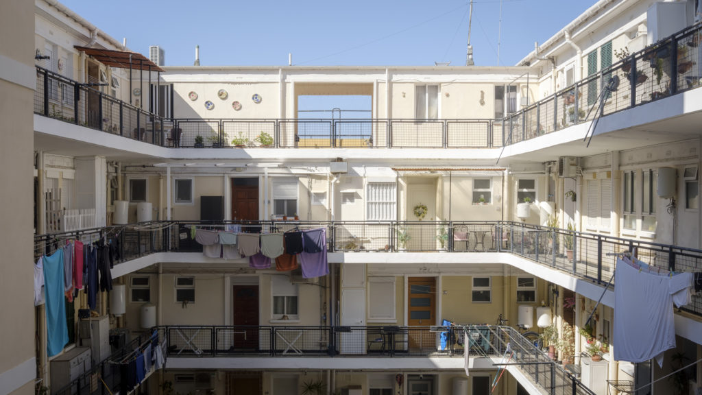
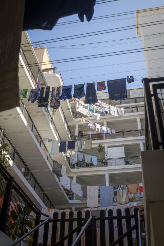
The property market is overheated. Most Gibraltarians live in council housing, which carries no social stigma. Council properties are passsed down through the generations. This beautiful, airy midcentury block tends to be occupied by older people, many of whom have lived in it since it was built.
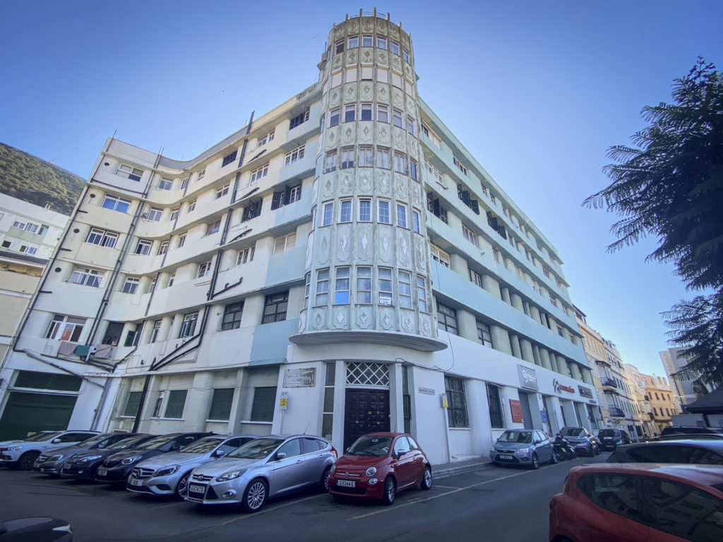
Further up the hill there are some more midcentury architectural gems.
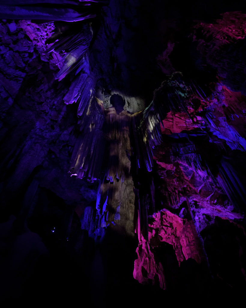
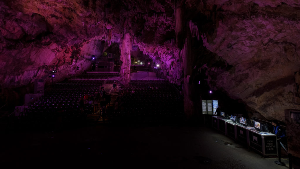
Inside the rock, alongside the WWII tunnels, there are also natural caves. St. Michael’s cave features a natural stalagtite formation that resembles an angel, and a theatre where visitors can watch a looping light show. The nature reserve on top of the rock overlaps almost exactly with MoD owned land, so I suspect a good chunk of my £30 park entry fee is really funding the British military. The charge is steep, but ultimately worth it. There’s a lot to see both above and below ground in the two-and-a-bit miles of hilly park.
The original harbour arm is tiny and derelict but still sees plenty of use as a playground, dog walking area, and fishing pontoon.
Many thanks to Jonathan Dawson and Darius Gui for being such wonderful hosts, introductions to the Chief Rabbi and a whole cast of other local luminaries, and a lovely lunch, and to Johnny Moss for the drunken history lessons and local demi-monde gossip. I’m looking forward to seeing you all again soon. :-)